Log in
All resources
Create a design
1,097,002 Free Images of Maps Of Ashtabula County
maps in the library of congress
dutch-language maps
baptista van doetecum
third voyage of willem barentsz
16th-century maps of the arctic
old maps of spitsbergen
maps of novaya zemlya
old maps of the arctic
old maps of the white sea
maps of the barents sea
old county maps of lancashire
copper engravings
maps of the elbe
alster (river)
third voyage of willem barentsz
16th-century maps of the arctic
third voyage of willem barentsz
16th-century maps of the arctic
third voyage of willem barentsz
16th-century maps of the arctic
overwintering on nova zembla by willem barentsz, 1596-1597
maps in the rijksmuseum amsterdam
third voyage of willem barentsz
history of dutch sea fisheries
third voyage of willem barentsz
history of dutch sea fisheries
the voyage of the vega round asia and europe
third voyage of willem barentsz
overwintering on nova zembla by willem barentsz, 1596-1597
maps in the rijksmuseum amsterdam
itinerario (jan huygen van linschoten)
latin-language maps
maps in the library of congress
maps of alexandria, virginia
ashtabula
ohio
works after map of amsterdam, 1544
ships on maps
17th-century maps of catalonia
coats of arms of catalonia
maps from the earth and its inhabitants, vol. vi
russia in the 19th century
maps from the earth and its inhabitants, vol. vi
charles eugène perron
maps from the earth and its inhabitants, vol. vi
russia in the 19th century
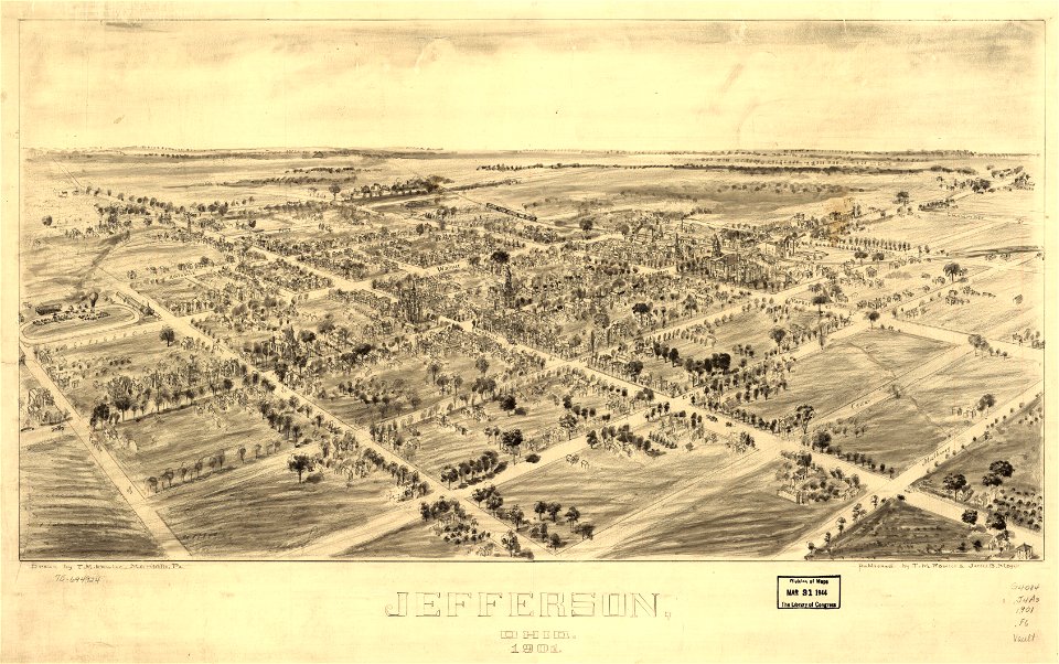
jefferson
ohio
jefferson
ohio
west-indische compagnie
image restoration
1639 maps
1670 maps
135th meridian east
tasman map
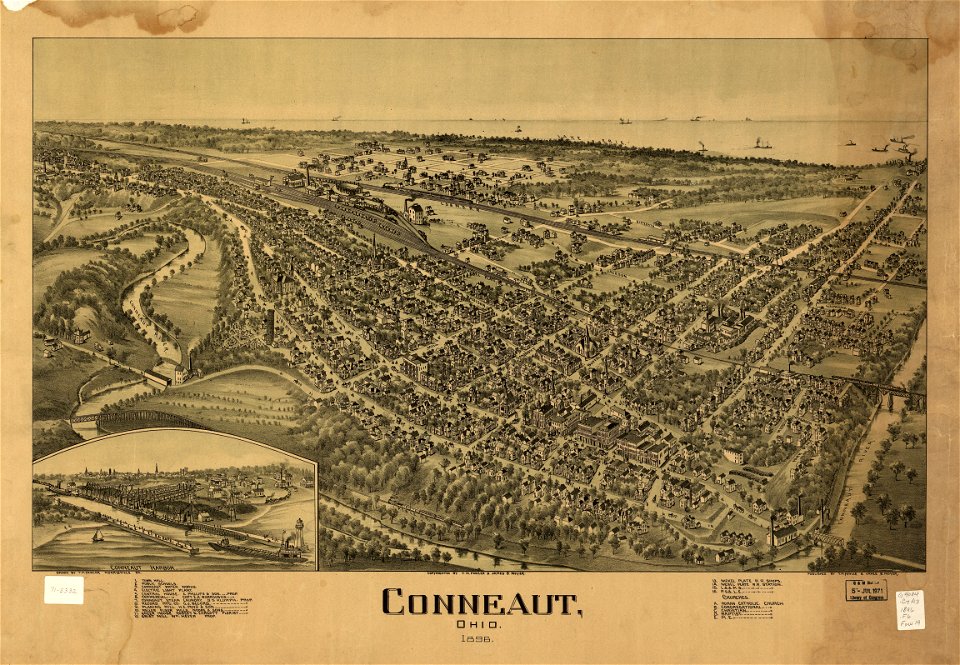
conneaut
ohio
conneaut
ohio
history of visualization
dot maps
maps of del norte county, california
1866 maps of california
maps from the earth and its inhabitants, vol. vi
maps indicating exploration
maps from the earth and its inhabitants, vol. vi
maps indicating exploration
male portraits by rembrandt
dutch golden age painting
17th-century maps of sri lanka
description de l'universe
william i of the netherlands (joseph paelinck - rijksmuseum amsterdam)
1819 portrait paintings of men
paintings by hans viggo westergaard in oslo museum
christian stockfleth
european interpretation of islamic art
old maps of baghdad
1876 maps
1884 maps
whig party (united states)
daguerreotype portraits
1660 in new york city
fort amsterdam
maps of mars by the mars global surveyor moc
maps of oxia palus quadrangle
island of california
image restoration
1876 maps
1884 maps
the generall historie of virginia (john smith)
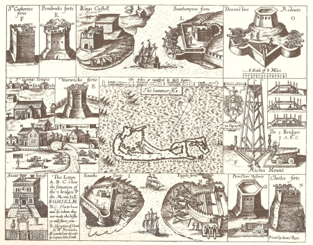
17th-century maps of bermuda
mathew brady photograph of franklin pierce
adam cuerden's restorations
lithographs in the los angeles county museum of art
1885 cartoons
historical maps of schmallenberg
atlas novus (blaeu)
old maps of spitsbergen
old maps of the arctic
jean-baptiste wicar
neoclassicism
maps of colonial brazil
atlas miller
1634 in maryland
romanticism
claes jansz. visscher (i)
joannes van doetecum (i)
portrait paintings in the maryland historical society
baroque
john dickinson by charles willson peale
neoclassicism
media from stadsarchief rotterdam
baroque
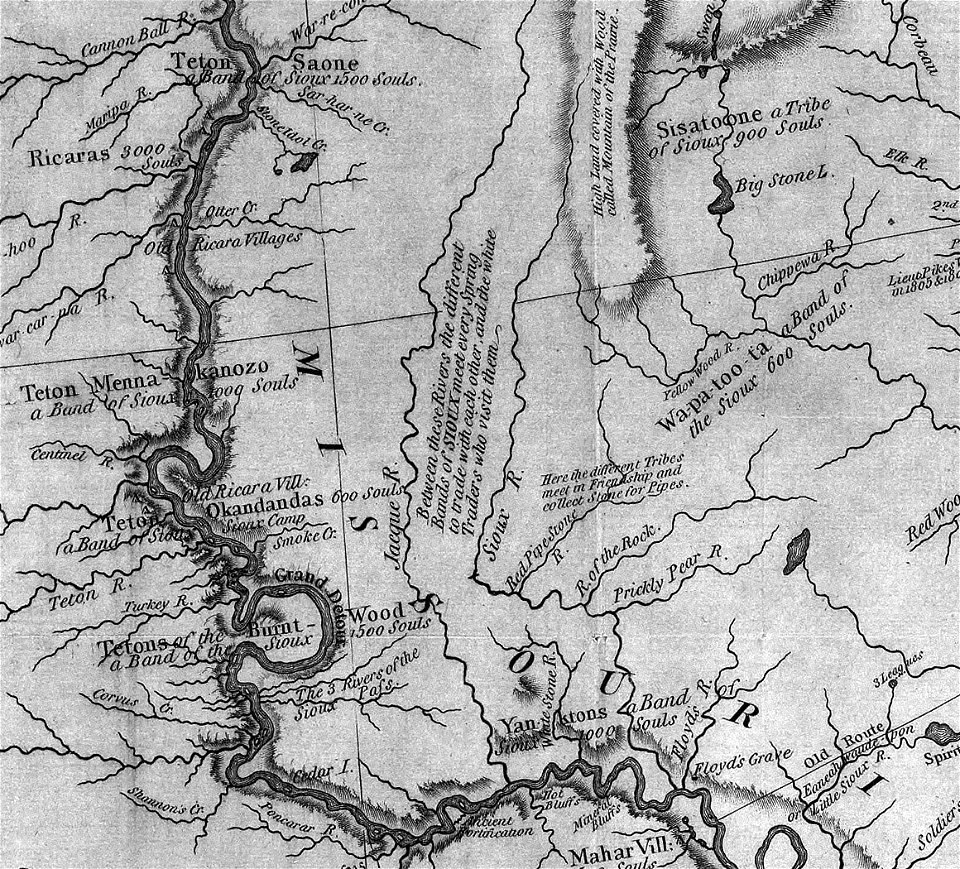
south dakota
iowa
typus orbis terrarum
1570 maps
paintings by jan styka
kazimierz pułaski
valleys and canyons on mars
mars topography
john william friso, prince of orange in art
lancelot volders
kaart van het baljuwschap kennemerland
maps in the rijksmuseum amsterdam
resurrection of lazarus (rembrandt)
dutch golden age painting
17th-century maps of iceland
copper engravings
paintings by christian august lorentzen
neoclassicism
paintings in the musée des arts décoratifs
paintings by pierre-antoine baudouin
grubleren (glyptotekshaven)
modern art,symbolism
paintings from pakistan in the los angeles county museum of art
watercolor paintings in the los angeles county museum of art
paintings of horses in the united states
paintings by c.c.a. christensen
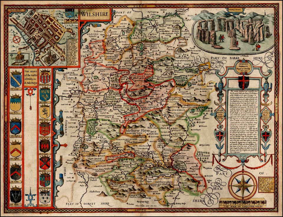
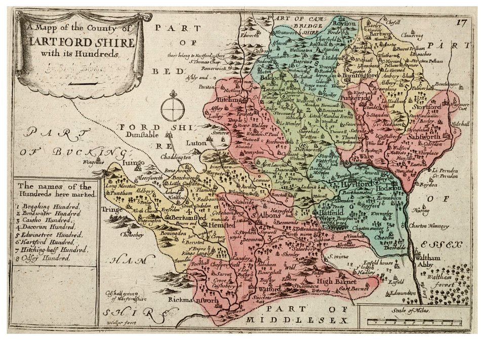
county maps of england by john speed
old county maps of hampshire
john eager howard
neoclassicism
county maps of england by john speed
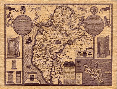
old county maps of cumberland
zhijin county
guizhou
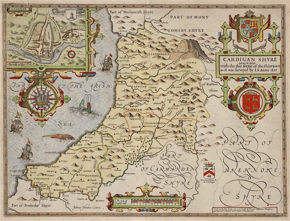
county maps of england by john speed
john speed
maps in the national library of wales
old county maps of cardiganshire
city investing building
astor house building
june 1923 united states photographs
1923 photographs of california
bruce county
ontario
county maps of england by john speed
nonsuch palace
maps of the county of flanders
old maps of flanders
maps of södermanland county
mariefred
university of toronto wenceslas hollar digital collection
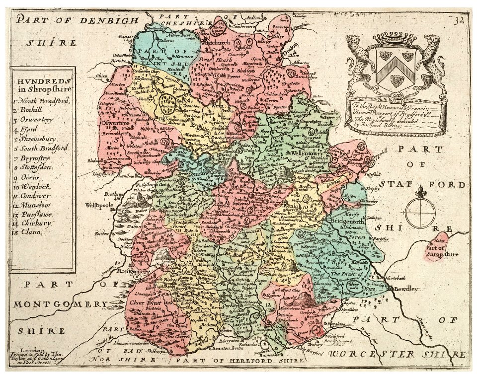
old county maps of shropshire
university of toronto wenceslas hollar digital collection
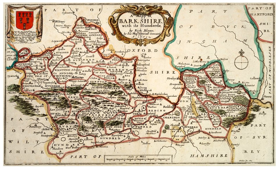
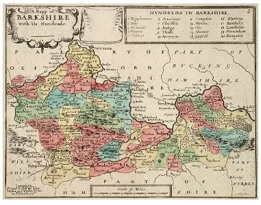
old county maps of berkshire
university of toronto wenceslas hollar digital collection
old county maps of berkshire
second boer war, 1899-1902 collection
second boer war
university of toronto wenceslas hollar digital collection
hollar maps and plans of london
old maps of stockholm county
maps of lidingö
maps made in the 17th century
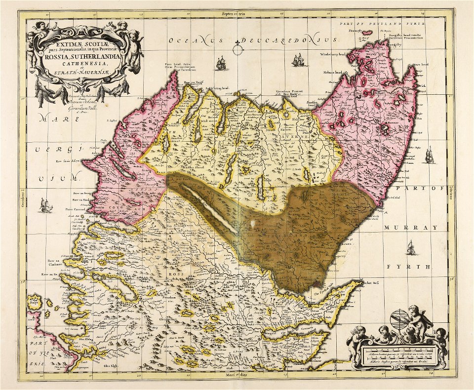
gerard valck
maps in the library of congress
california
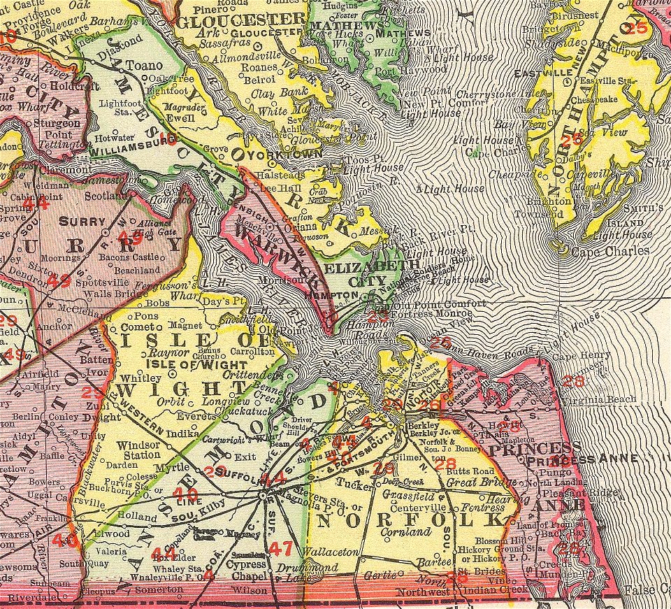
norfolk county
virginia
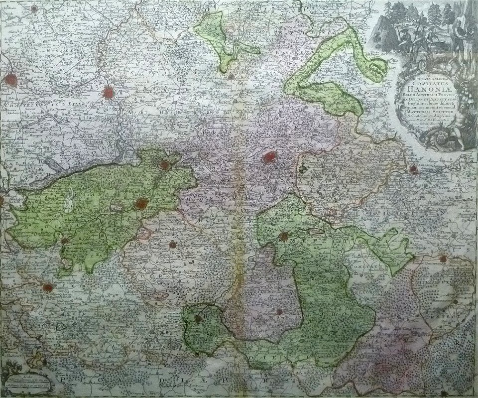
maps by matthäus seutter
county of hainaut
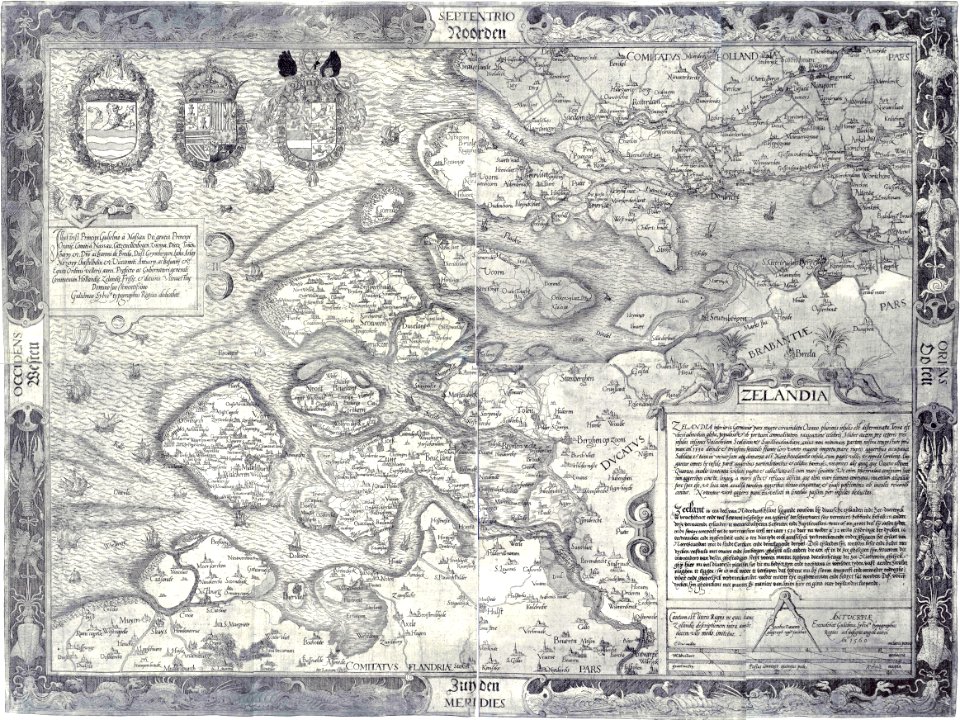
maps by jacob van deventer
old maps of zeeland
university of toronto wenceslas hollar digital collection
history of watford
university of toronto wenceslas hollar digital collection
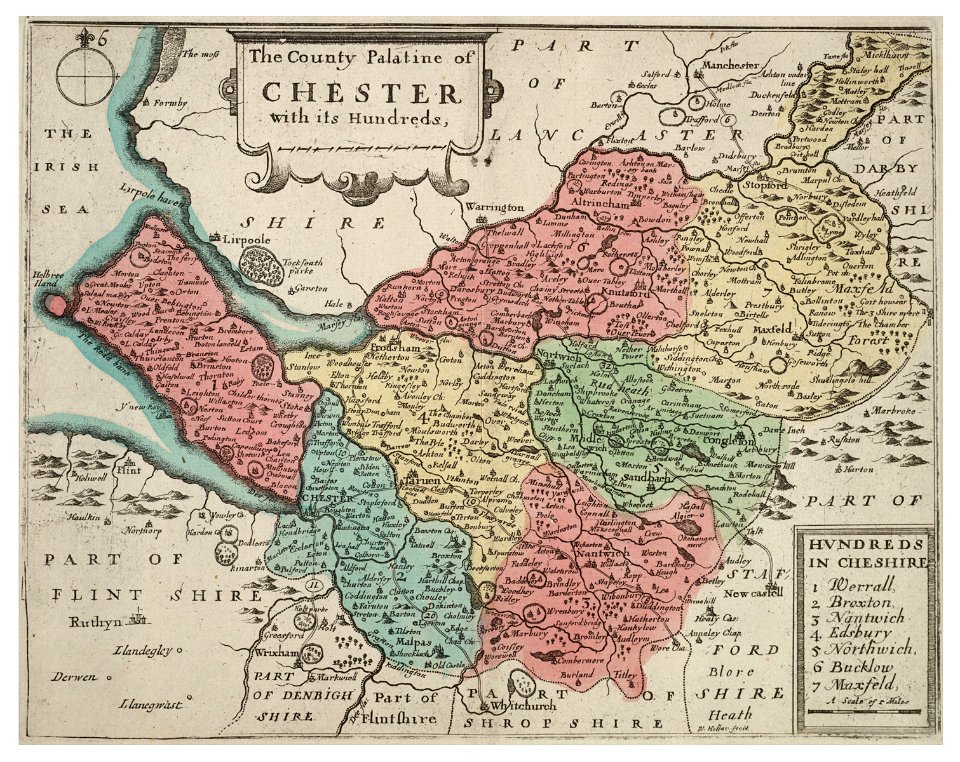
old county maps of cheshire
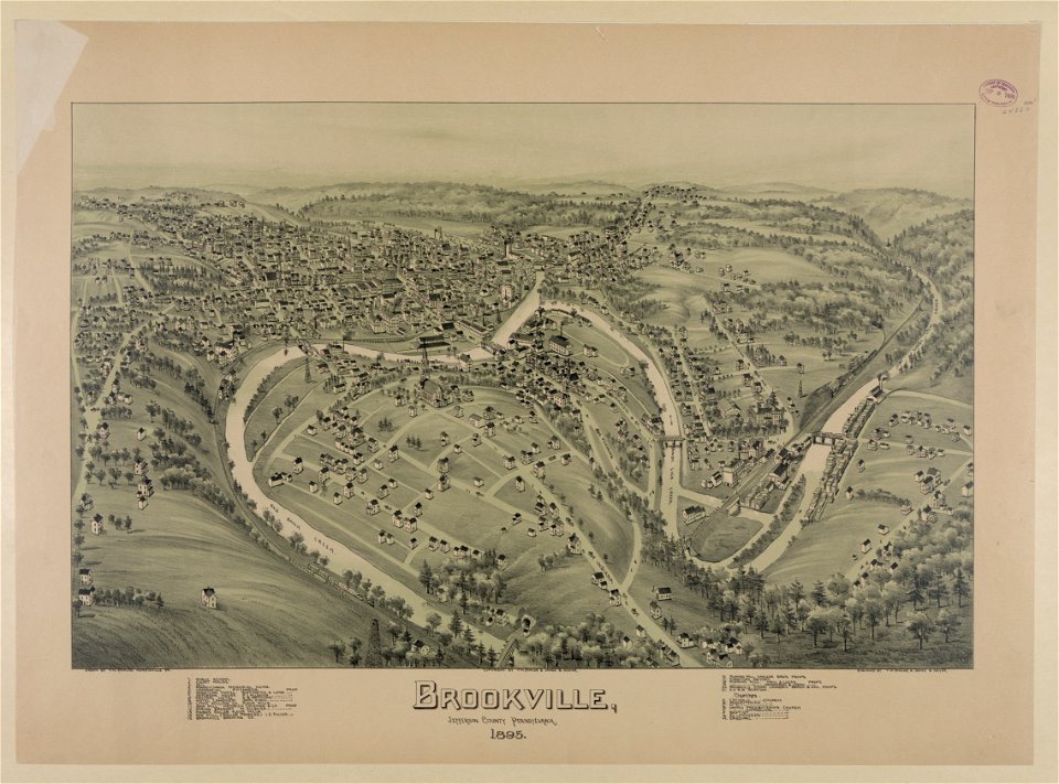
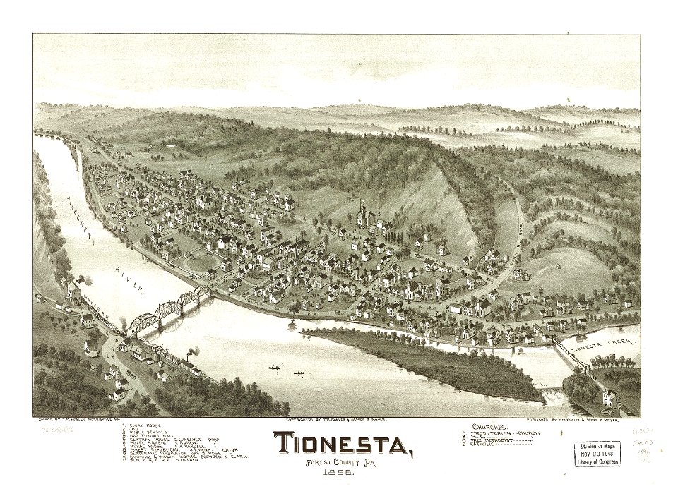
bird's eye view maps of pennsylvania
pennsylvania
maps in the library of congress
pennsylvania
maps in the library of congress
pennsylvania
maps in the library of congress
maps by jodocus hondius
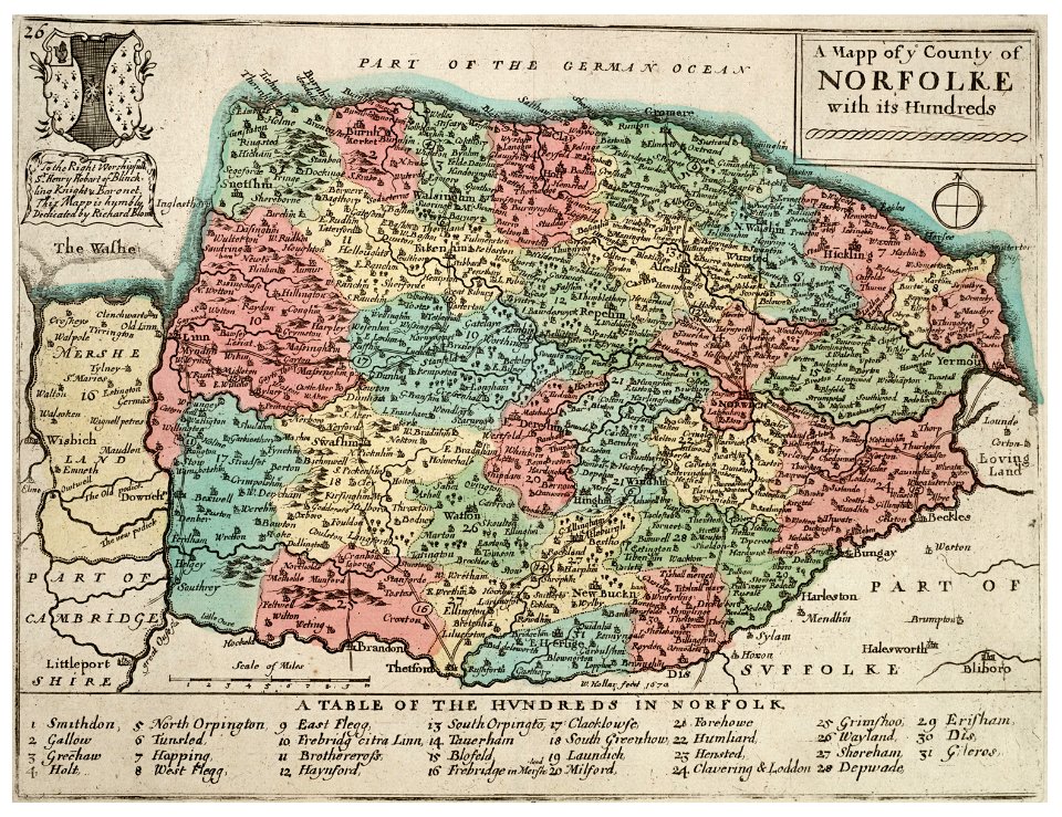
history of norfolk
england
historia de gentibus septentrionalibus
öland
senators of the united states from maryland
governors of maryland
19th-century maps of sweden
old maps of jämtland county
maps in the library of congress
pennsylvania
maps in the library of congress
pennsylvania
1 - 100 of 1,097,002
Next page
/ 10971


![[Nautical Atlas of the World, called Miller Atlas]; 2-5. [Miller Atlas: sheets 2 to 5]. sheet 5, António de Holanda, 1519](https://cdn.creazilla.com/illustrations/10000850095/nautical-atlas-of-the-world-called-miller-atlas-2-5-miller-atlas-sheets-2-to-5-sheet-5-antnio-de-holanda-1519-sm.webp)